
Introduction
California State Route 1—the Pacific Coast Highway—links San Francisco and Los Angeles via Monterey Bay, Big Sur’s dramatic cliffs, San Simeon, and Santa Barbara. Driving north to south places coastal pullouts directly on your right-hand side.
Route Overview & Interactive Stop Map
Expect unhurried two-lane cliffside driving through Big Sur with frequent ocean viewpoints, shifting marine fog in summer mornings, and wide coastal freeways south of Santa Barbara.
Schematic route plotted from verified stop coordinates. Total base route: 740 km (460 mi).
Suggested Route Stops & Distances
-
Day 1 — San Francisco (Golden Gate)
Start near the Presidio and head south along Highway 1 past Half Moon Bay. -
Day 1 — Monterey & Carmel-by-the-Sea
(+190 km / ~145 min drive)
Coastal aquarium corridor, 17-Mile Drive, and Carmel village. -
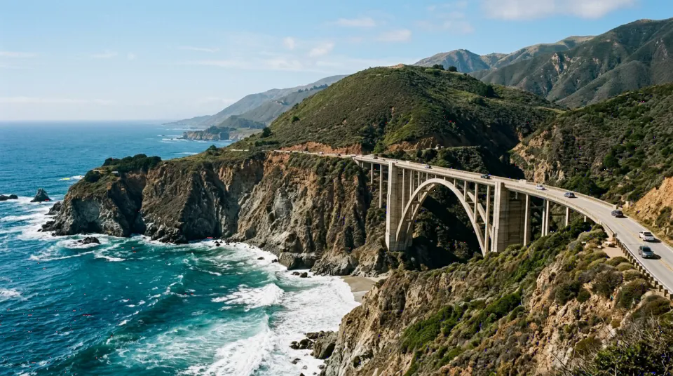
Day 2 — Big Sur & Bixby Bridge
(+75 km / ~75 min drive)
Iconic coastal arches, redwood canyons, and Pacific overlooks. -
Day 3 — San Luis Obispo / Cambria
(+155 km / ~130 min drive)
Central Coast elephant seal rookeries and laid-back downtown. -
Day 4 — Santa Barbara
(+165 km / ~110 min drive)
Spanish Revival architecture, palm waterfront, and mountain backdrop. -
Day 5 — Santa Monica / Los Angeles
(+155 km / ~115 min drive)
Finish along Malibu’s coastline at Santa Monica Pier.
Day-by-Day Itinerary
- Day 1: San Francisco to Monterey & Carmel-by-the-Sea (190 km / 118 mi).
- Day 2: Big Sur coast, Bixby Creek Bridge & Julia Pfeiffer Burns State Park (125 km / 78 mi).
- Day 3: Cambria, Paso Robles or San Luis Obispo (105 km / 65 mi).
- Day 4: Santa Barbara coastal mission & harbor (165 km / 102 mi).
- Day 5: Malibu beaches to Santa Monica Pier (155 km / 96 mi).
Driving Considerations
- Verify active Big Sur Highway 1 road status with Caltrans QuickMap before departing, as coastal rockslides occasionally require detours via US-101.
- Fuel up in Carmel or Cambria before entering the sparse Big Sur corridor.
- If renting in San Francisco and dropping off in Los Angeles, review one-way rental fees upfront.
Fuel Consumption & Trip Budget Planning
Approximately 460 miles (740 km) point-to-point; allow extra mileage for 17-Mile Drive and state park detours. Fuel prices in coastal Big Sur stations run noticeably higher than inland US-101 towns.
Compare Car Rental Options → Estimate Full Road Trip Cost → Calculate Fuel Only
Accommodation Planning Suggestions
Reserve Monterey, Big Sur, and Santa Barbara lodgings months ahead for summer weekends; Paso Robles and San Luis Obispo offer more mid-range inventory.
Car Rental Considerations
A comfortable mid-size sedan or crossover handles Highway 1 curves cleanly while offering good trunk space for luggage out of sight at scenic pullouts.